Lincolnshire is a county in the east of England, with a long coastline on the North Sea. It is divided between the East Midlands and the Yorkshire and Humber regions. It borders Norfolk to the south-east, Cambridgeshire to the south, Rutland to the south-west, Leicestershire and Nottinghamshire to the west, South Yorkshire to the north-west, and the East Riding of Yorkshire to the north. It also borders Northamptonshire in the south for just 20 yards (19 m), England’s shortest county boundary. The county town is Lincoln, where the county council is also based.
The ceremonial county of Lincolnshire consists of the non-metropolitan county of Lincolnshire, which is in the East Midlands region, and the areas covered by the unitary authorities of North Lincolnshire and North East Lincolnshire, which are in the Yorkshire and the Humber region. The county is the second-largest of the English ceremonial counties and one that is predominantly agricultural in land use. The county is fourth-largest of the two-tier counties, as the unitary authorities of North Lincolnshire and North East Lincolnshire are not included.
The county has several geographical sub-regions, including the rolling chalk hills of the Lincolnshire Wolds, the Lincolnshire Fens (south-east Lincolnshire), the Carrs (similar to the Fens but in north Lincolnshire), the industrial Humber Estuary and North Sea coast around Grimsby and Scunthorpe, and in the south-west of the county, the Kesteven Uplands, rolling limestone hills in the district of South Kesteven.
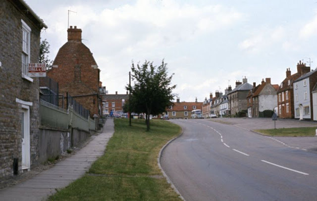
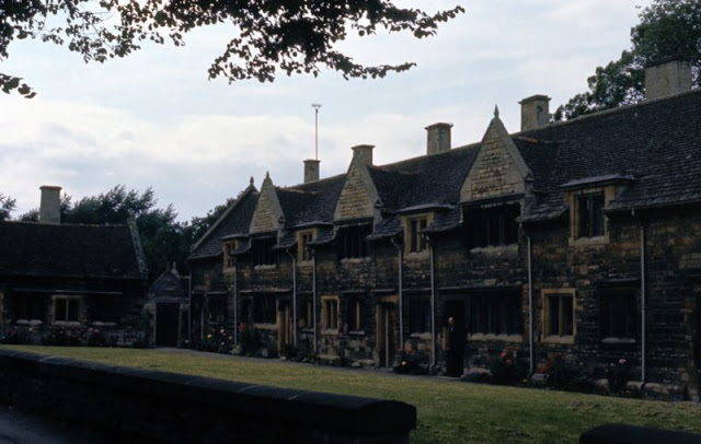
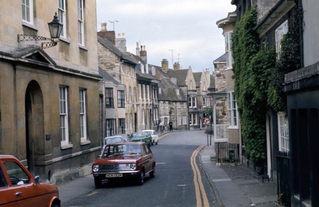
These vintage photos from daves_archive1 that captured street scenes of Lincolnshire in the 1970s.
 |
| Bourne, Lincolnshire, looking from West Street to North Street (left) and South Street (right), circa 1970s |
 |
| Barn Hill, Stamford, Lincolnshire, circa 1970s |
 |
| Barn Hill, Stamford, Lincolnshire, circa 1970s |
 |
| Browne's Hospital, Stamford, Lincolnshire, circa 1970s |
 |
| Browne's Hospital, Stamford, Lincolnshire, circa 1970s |
 |
| Folkingham, Lincolnshire, circa 1970s |
 |
| Folkingham, Lincolnshire, circa 1970s |
 |
| Folkingham, Lincolnshire, circa 1970s |
 |
| Folkingham, Lincolnshire, circa 1970s |
 |
| Ingham Road, Stow, Lincolnshire, circa 1970s |
 |
| Ingham Road, Stow, Lincolnshire, circa 1970s |
 |
| Ingham Road, Stow, Lincolnshire, circa 1970s |
 |
| Lincolnshire, circa 1970s |
 |
| Lord Burghley's Hospital, Stamford, Lincolnshire, circa 1970s |
 |
| St Edith's, Coates by Stow, Lincolnshire, circa 1970s |
 |
| St George's church, Stamford, Lincolnshire, circa 1970s |
 |
| St Mary's Street, Stamford, Lincolnshire, circa 1970s |
 |
| St Mary's Street, Stamford, Lincolnshire, circa 1970s |
 |
| St Mary's, Stow, Lincolnshire, circa 1970s |
 |
| St Mary's, Stow, Lincolnshire, circa 1970s |
 |
| Stamford, Lincolnshire, circa 1970s |
 |
| Stamford, Lincolnshire, circa 1970s |
 |
| Stamford, Lincolnshire, circa 1970s |
 |
| Stamford, Lincolnshire, circa 1970s |

|
| Stamford, Lincolnshire, circa 1970s |

|
| Stamford, Lincolnshire, circa 1970s |

|
| Stamford, Lincolnshire, circa 1970s |

|
| The Greyhound Inn at Folkingham, Lincolnshire, circa 1970s |

|
| The Manor House, Folkingham, Lincolnshire, circa 1970s |